
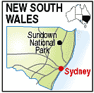
New South Wales - Queensland Border

Much of the area was cleared for grazing and the remains of yards and fencing remind of the days when wool was produced. Some mining occured from the 1870s
Jibbinbar Mountain in the north-west and the eroded Red Rock Gorge are intrusions of granite into the traprock. Several granite dykes occur with one lead through the entire area resulting in the formation of 'Rats Castle' a local landmark on the river.

